Newsletters
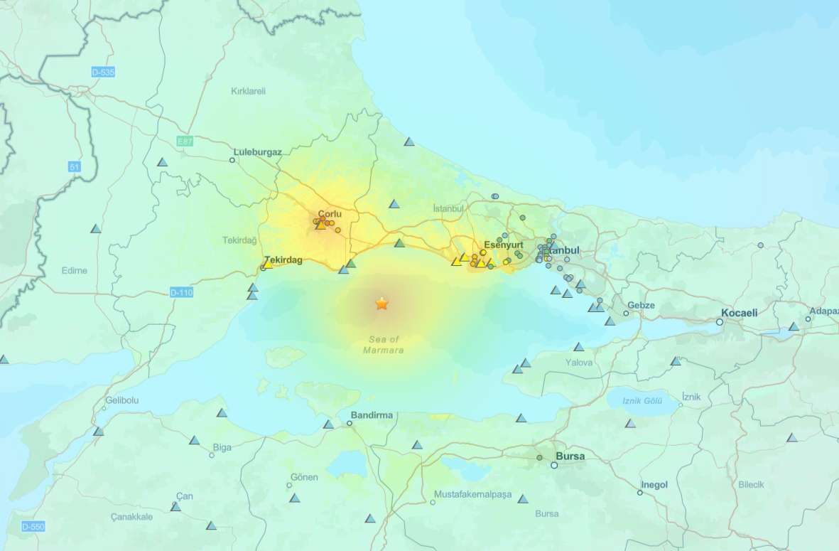

A powerful earthquake off the coast of Silivri sent tremors rippling through Istanbul, causing panic among residents and significant variation in perceived shaking across the city. According to data from the United States Geological Survey (USGS) and Türkiye’s Disaster and Emergency Management Authority (AFAD), the quake was felt at differing intensities in each district.
The epicentre of the earthquake, which registered a magnitude of 6.2, was located offshore near Silivri. The seismic waves were strongest in Istanbul’s western districts, gradually diminishing in intensity toward the eastern parts of the city.
Aftershocks were recorded throughout the day, adding to the anxiety of millions of residents.
A detailed USGS map has revealed the varying intensity levels down to the street level, painting a vivid picture of how the earthquake impacted different neighbourhoods. The map is available to the public and offers a close look at how the seismic waves affected each part of Istanbul.
Explore the intensity map here.
The following are estimated intensities of shaking reported across Istanbul’s districts:
Despite the strength of the quake, initial reports indicate that there has been no widespread structural damage. Authorities continue to monitor the situation, and emergency services remain on alert.
AFAD has urged residents to remain vigilant in the event of aftershocks and to follow official guidance. Earthquake preparedness continues to be a priority in Istanbul, a megacity built near the North Anatolian Fault line.


 1 min read